Babylonian Geography
Babylonia is flat land that has 2 main rivers named the Tigris and Euphrates. Mountains appear in the north and east sides of the land, the Zagros chain and Kurdistan chain, and the Syrian and Arabian deserts are in the west and southern part of the land.
In the summer the climate is hot and very dry. The winter though is cold and moist. In the spring the Tigris and Euphrates rivers start to consume a lot of water that make parts of the land flood.
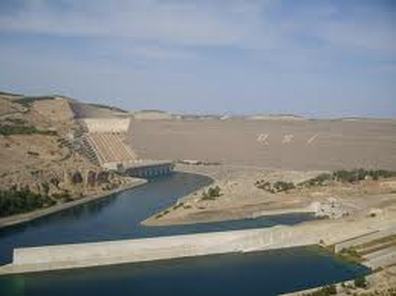
Below shows a picture of Euphrates and a catchy video to help you remember the Euphrates and Tigus rivers are in Babylon and history of the Euphrates River.
http://www.youtube.com/watch?v=b5WVUS1sVBQ
http://www.mesopotamia.co.uk/geography/home_set.html
en.wikipedia.org/wiki/Babylon http://www.wmf.org/project/future-babylon
